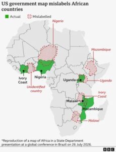





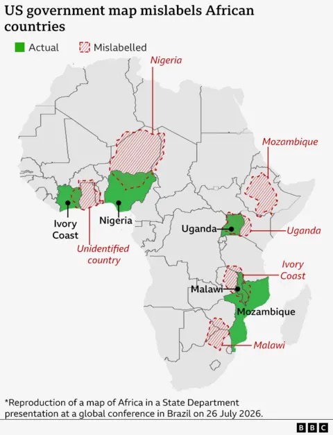
The United States Department of State has acknowledged responsibility for displaying an inaccurate map of Africa during an official conference in Brazil, following widespread criticism over significant geographical errors that misrepresented the continent’s countries and borders.
The map, which was used during a presentation at the international event, incorrectly placed several African countries in the wrong locations while also depicting inaccurate national boundaries. Images of the map quickly circulated on social media, prompting criticism from African officials, academics, and members of the public who described the mistakes as both embarrassing and disrespectful.
Responding to the backlash, a spokesperson for the US State Department said the department takes “full responsibility” for the error and expressed regret over the incident. Officials indicated that the map was displayed unintentionally and did not reflect the United States government’s official geographic representations or foreign policy positions.
The incident has reignited long-standing concerns about how Africa is portrayed by international institutions and foreign governments. Critics argue that such mistakes reinforce stereotypes that the continent is often treated as a single entity rather than a diverse region made up of 54 internationally recognised countries, each with its own unique history, culture, and political identity.
Geographers and international affairs experts noted that inaccuracies involving African maps are particularly sensitive because borders carry significant historical and political importance. Many of Africa’s modern boundaries were established during the colonial era, and errors in depicting them can create diplomatic misunderstandings or be perceived as a lack of respect for national sovereignty.
Several African commentators also questioned how such a flawed map passed multiple stages of preparation before being presented at a high-level international conference. They argued that official government events should be subject to rigorous fact-checking, particularly when discussing global affairs involving multiple countries.
While the State Department’s public acceptance of responsibility has been welcomed by some observers, many believe the incident highlights the need for greater geographical literacy and cultural awareness within international organisations. Analysts say accurate representation of Africa is essential for fostering respectful diplomatic relations and meaningful engagement with the continent.
The controversy also underscores the growing influence of social media in holding institutions accountable. Within hours of the images being shared online, users across Africa and beyond pointed out the inaccuracies, leading to widespread international attention and prompting the State Department’s response.
Although the error is unlikely to have any direct diplomatic consequences, it serves as a reminder of the importance of precision in official communications. As Africa’s geopolitical and economic influence continues to expand on the global stage, observers say international partners must ensure that the continent is represented accurately and respectfully in all official materials.
For many Africans, the episode is about more than a mistaken map. It reflects a broader expectation that global institutions and governments engage with the continent based on knowledge, accuracy, and respect—qualities that are fundamental to building stronger international partnerships.