
INTELLIGENCE ASSESSMENT: Extreme
REGION: Western Pacific
COUNTRIES/TERRITORIES: Guam, Northern Mariana Islands, Philippines, Taiwan, Japan
CATEGORY: Severe Weather / Natural Hazards
STATUS: Active
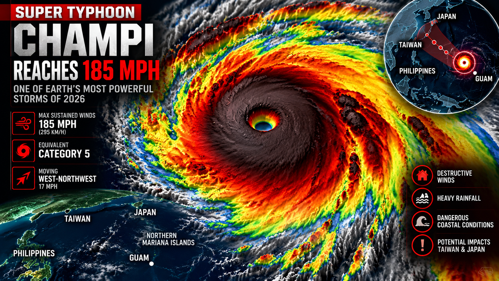
Super Typhoon Champi has intensified into an exceptionally powerful tropical cyclone, reaching maximum sustained winds of 185 mph (295 km/h) as it moves west-northwest across the western Pacific.
The U.S. National Weather Service’s latest advisory on October 21 placed Champi approximately 970 miles west-northwest of Guam, with the storm moving west-northwest at about 17 mph. The agency reported that typhoon-force winds extended outward as far as 100 miles from the center, while tropical-storm-force winds extended nearly 290 miles. (National Weather Service)
The intensity places Champi at the equivalent of a Category 5 hurricane on the Saffir-Simpson scale. Its 185-mph sustained winds also tie the highest wind speed recorded by a tropical cyclone on Earth during 2026, according to AccuWeather. (AccuWeather)
A Rapidly Intensifying Pacific Giant
Champi developed in an environment highly favorable for rapid intensification, including exceptionally warm ocean water, abundant atmospheric moisture and relatively weak wind shear.
The storm underwent several periods of rapid strengthening after forming in the western Pacific. Earlier in its development, forecasters warned that Champi could become one of the strongest storms of the year. (The Washington Post)
Satellite imagery has shown an unusually well-defined eye and powerful eyewall structure. The storm’s intensity has been remarkable even by western Pacific standards, where some of the world’s strongest tropical cyclones routinely develop.
Guam Narrowly Avoided the Core
Champi previously passed extremely close to Guam.
The Government of Guam reported that the storm’s center passed approximately 10 miles south of Merizo on October 18. Residents experienced damaging winds, heavy rainfall and dangerous coastal conditions, while officials urged people to remain indoors and avoid flooded roads and the coastline. (Guam Government House)
The storm’s most destructive eyewall narrowly missed the island. The National Weather Service reported that the eye was only around five to six miles wide during the Guam encounter, illustrating how small changes in the storm’s track could have produced substantially different impacts. (Marine Weather)
Typhoon warnings for Guam and neighboring islands were subsequently cancelled as Champi moved westward away from the Marianas. (Iowa Environmental Mesonet)
What Happens Next
As of the latest National Weather Service advisory, Champi is expected to begin a gradual weakening trend over the coming days. Nevertheless, the system remains an extremely powerful tropical cyclone capable of producing destructive winds and dangerous seas far from its center. (National Weather Service)
Forecast guidance has been tracking the system toward the western Pacific and the broader region of Taiwan and Japan. AccuWeather reported that Champi was moving toward Taiwan, while forecasts indicated potential impacts farther north and west as the storm progresses. (AccuWeather)
The greatest immediate significance of Champi is therefore not only its potential land impacts but its extraordinary intensity over open water.
Why Champi Matters
A storm reaching 185 mph sustained winds represents an extraordinary concentration of atmospheric energy. Champi demonstrates how rapidly a tropical system can transition from a developing disturbance into a Category 5-equivalent super typhoon when environmental conditions align.
For communities across the western Pacific, the storm is another reminder that storm intensity can increase dramatically in a matter of hours, leaving limited time for preparation.
With Champi now moving away from Guam, attention is shifting toward its future track, weakening rate and potential effects farther west in the Pacific.
Assessment: Champi remains an extreme meteorological event. Its 185-mph sustained winds make it one of the strongest tropical cyclones observed globally in 2026, and its continued evolution warrants close monitoring across the western Pacific.
Leave a Reply